Story

Rock, river,vine.

Porte de fer is French for the Iron Gate, the gorge at the edge of town. This is what surrounds the bar, and why it matters to what we pour.

Scroll to travel the map

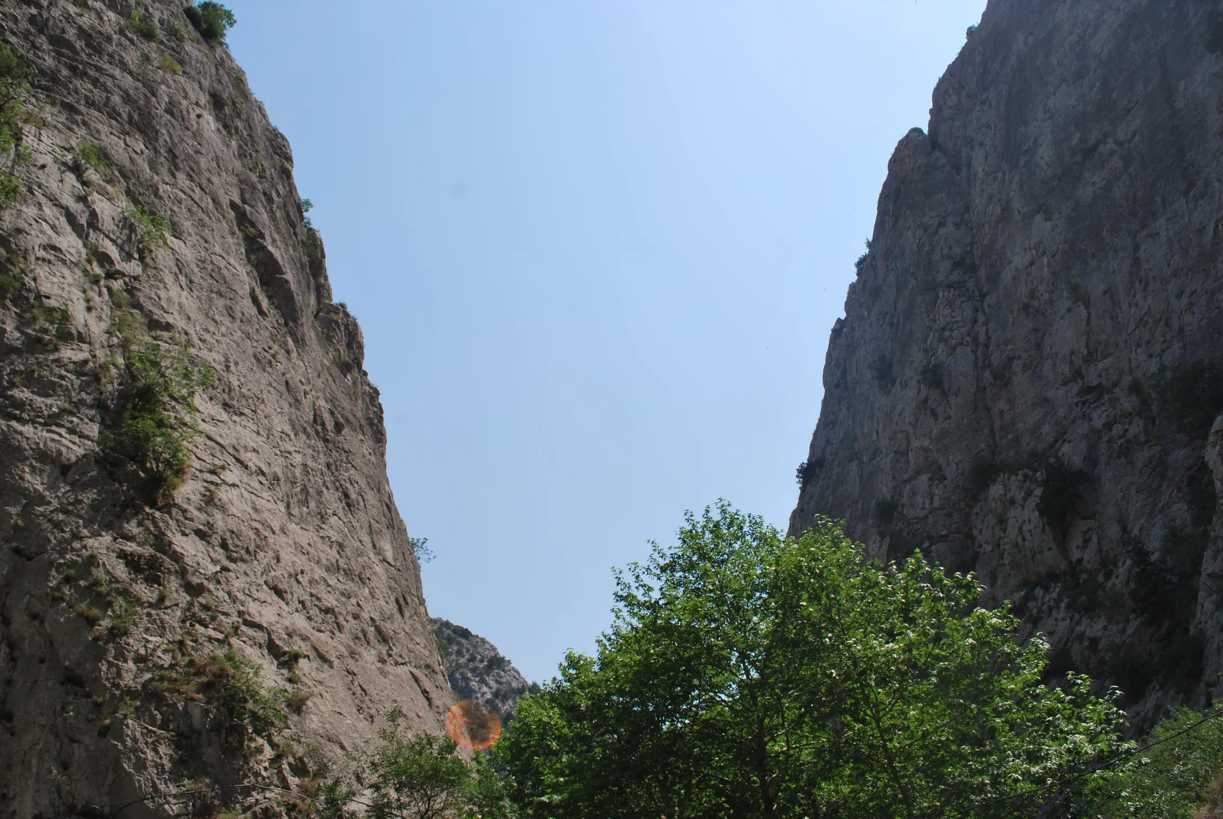
Limestone walls of the Demir Kapija gorge rising above the trees

01The gate

A gorge with three names.

Greek writers called the pass Stenae, the narrows. In the Middle Ages the fortress above it was Prosek. The Ottomans named it Demir Kapı, the Iron Gate, and that name stayed.

We say it in French, as the oenologists who advised the royal estate here in the 1920s would have.
02The rock

Limestone, bolted.

The walls of the gorge are limestone, and climbers have equipped them. The nearest sector is ten minutes on foot from the centre of town, and most of the others are close to the road.

  • 16Sectors
  • 200+Sport routes
  • 4 to 8cGrades

03The sky

The bird on our door.

Egyptian vultures nest on these cliffs, and the gorge is an Important Bird Area of 10,500 hectares. The bird in our mark is that vulture. It is endangered, which is reason enough to look up.

  • 10,500 haImportant Bird Area

04The vine

The warm end of Tikveš.

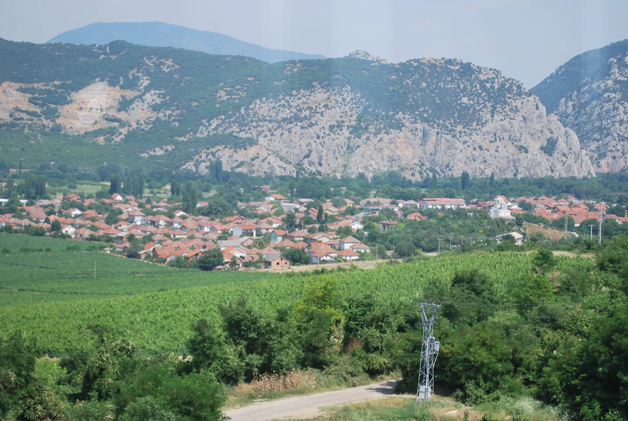
Demir Kapija lies at the southern end of Tikveš, the largest wine region in the country. North Macedonia’s highest temperature was measured here on 24 July 2007.

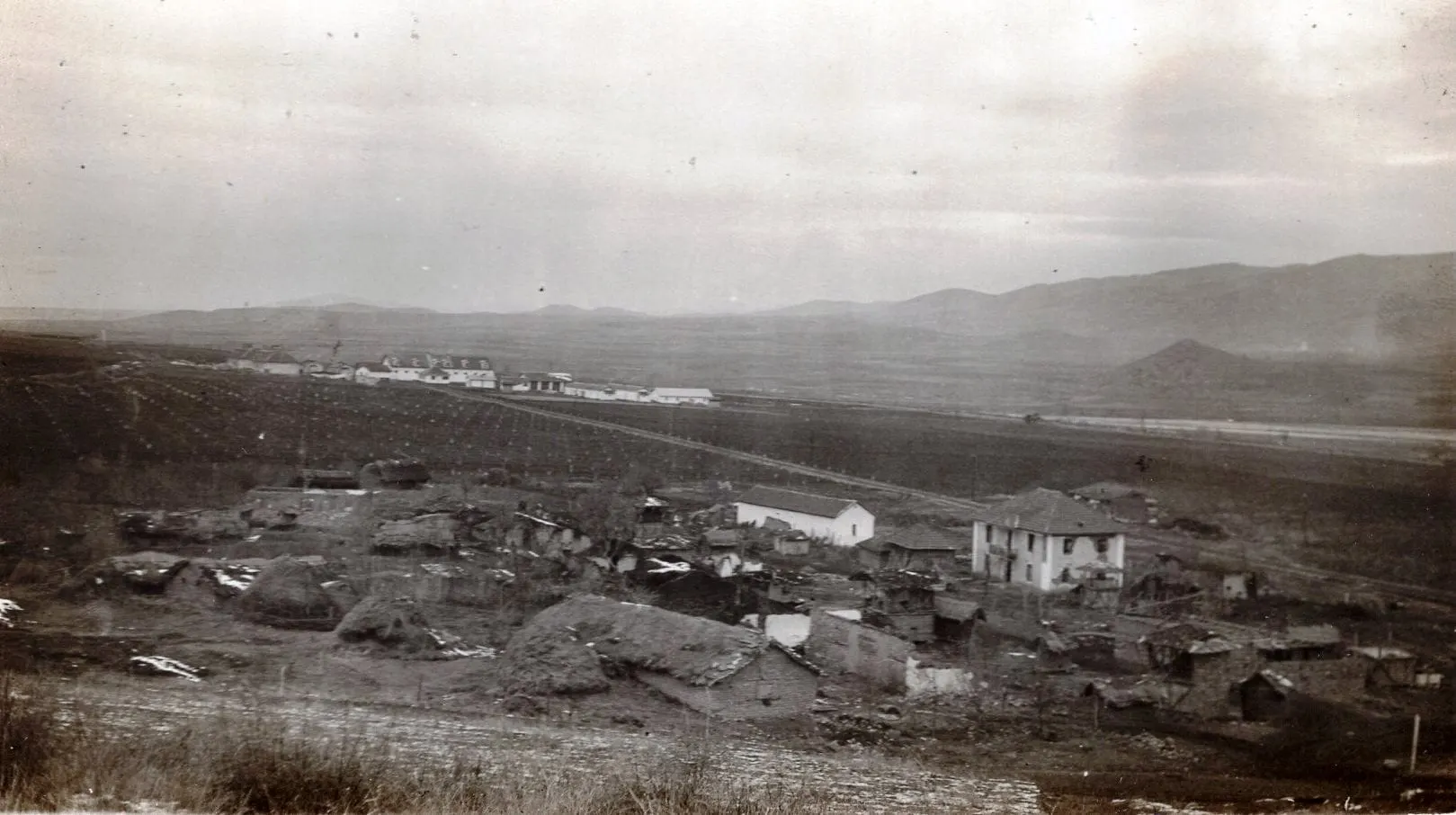
In 1928 King Alexander I founded a winery at the edge of town on the advice of French oenologists. It is still making wine.

  • 45.7 °CNational record, 2007
  • 1928Royal winery founded

05Three terroirs

One valley, three altitudes.

Within a few kilometres the ground rises from the river to the mountain, and the wine changes with it. Three named sites mark the climb.

  1. 1Popova Kula182 m
  2. 2Beshvichki Livadki400 m
  3. 3Barovo600 to 700 m

06The bar

Where the day ends.

The bar is on 11 Oktomvri street, in the centre of town. We are not a winery. We choose wines from the producers around us, open them by the glass, and serve boards that need no kitchen.

Relief drawn from elevation data (Mapzen, SRTM). Rivers, railway and motorway © OpenStreetMap contributors. Vineyard positions are indicative.

Three terroirs

The three sites, side by side.

  1. 01

    182 m

    Popova Kula

    Limestone soil on a gentle slope facing south and south-west, with more than 280 days of sun a year. Warm wind arrives from the gorge by day and cooler air from Kožuf follows in the evening.

    PlantedStanušina, Vranec, Cabernet Sauvignon, Žilavka

  2. 02

    400 m

    Beshvichki Livadki

    Well-drained limestone with a neutral to northern exposure, reached earlier by the mountain air. The grapes hold their acidity, which is why most of the whites are planted here.

    PlantedTemjanika, Chardonnay, Sauvignon Blanc, Muscat Ottonel, Žilavka, Prokupec

  3. 03

    600 to 700 m

    Barovo

    The highest of the three. Mediterranean air arriving through the gorge meets the mountain climate of Kožuf over carbonate clay and volcanic deposits. Days and nights differ widely, and the fruit ripens slowly.

    PlantedSauvignon Blanc, Chardonnay, Temjanika, Vranec, Kratošija

Altitude / Distance from the river

  1. Popova Kula

    182 m

    Limestone, facing south

  2. Beshvichki Livadki

    400 m

    Higher, cooler, northern light

  3. Barovo

    600 to 700 m

    Where two climates meet

Figures as published by Popova Kula Winery and Tikveš Winery.

Why it matters

The same stone, twice.

The limestone that gives climbers their holds also drains the vineyards, and growers credit it for the mineral edge in their wines. The gorge that closes the valley is the channel that ventilates it.

A day here can start on the rock and finish with a glass of what the rock grows.

Black and white photograph of the royal winery estate near Demir Kapija in the 1930s
The royal estate outside Demir Kapija, photographed in the 1930s.